What is the history of aerial photography?
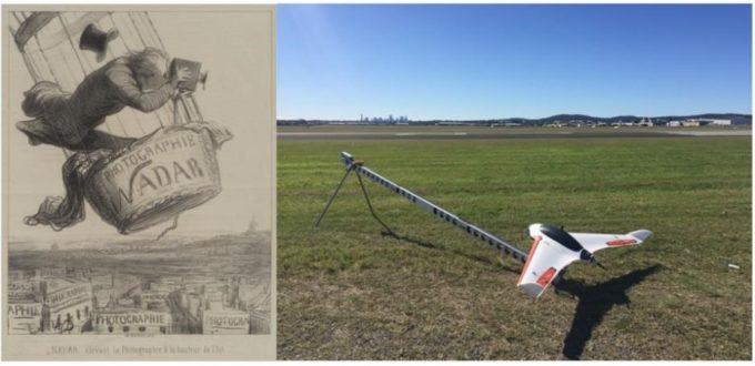
The first known aerial photographs were taken in the 1858 century by Gaspar Felix Tournachon (a French balloonist). Cameras were then attached to kites (1882), rockets (1897), aeroplanes (1909) and satellites (1959).
During the 1980’s colour images became mainstream and in the 1990’s innovative businesses were carrying out surveys for customers. In the early 2000’s digital aerial survey cameras became commercially available and were widely used on manned aircraft.
Today, Unmanned Aerial Vehicles (UAVs) that are aircraft piloted by remote control or onboard computers (commonly referred to as drones) can be used to economically gather both aerial photographs and digital terrain models.
UAV’s allow the production of high-quality aerial imagery while also gathering digital survey data using LiDAR.
What are the advantages of using UAV’s?
UAV’s have the capability to fly (almost) anywhere and at significantly lower altitudes than manned aircraft and are therefore less likely to be affected by clouds (this can be an issue related to aerial photography experienced by normal aircraft or satellites).
Aerial imagery obtained at lower-heights can have a significantly higher resolution (up to 10mm pixel) than a satellite. UAV’s also have a capability of achieving +/- 25mm horizontal and vertical point accuracies.
UAV’s utilise an on-board “direct geo-referencing” system which enables rapid data capture with no pre-targeting required. They can fly in winds up to 35-40km/h and can survey areas up to 8km2 per day. The survey data is in the form of 3D bare earth point cloud (point density of 1 point per 50mm) which can be used to create a Digital Elevation Model, Digital Terrain Model and 3D contours.
What are the disadvantages of using UAV’s?
There are a variety of potential limitations for UAV use, including but not limited to:
- Not being able to gather survey data on below-ground infrastructure (such as obtaining the inverts of pipes, pits and utility services);
- Accuracy typically being suitable for concept designs (+/- 25mm) rather than detailed designs (unless the tolerance is acceptable to the client); and
- Longer lead times than traditional ground-based survey due to airspace approval requirements.
Should I select ground-based, aerial and satellite surveys?
The choice between the use of ground-based, aerial and satellite survey methods is dependent upon an array of variables. A brief overview of potential advantages and disadvantages are provided in Figure 1 (note, this does not consider costs associated with each type of survey).
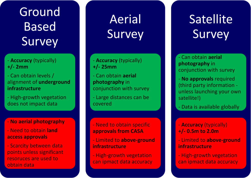
Figure 1 – Typical benefits and disadvantages of ground, aerial and satellite survey data
What is the process for obtaining aerial imagery with a UAV in Australia?
The process to obtain aerial imagery and survey in Australia involves the following:
- Coordinating Civil Aviation Safety Authority (CASA) approval to undertake the survey;
- Establishing survey accurate Ground Control Points;
- Extracting 3D “bare earth” point data set of ground areas visible on aerial imagery;
- Extracting 3D Digital Terrain Model (DTM) in 3D DWG, DGN & 12D format;
- Generating contours of ground areas visible on aerial imagery;
- Generating a high resolution ortho-photo mosaic; and
- Creating CAD survey plan(s) with topographical data and ortho-photo mosaic.
Avmap were recently engaged to obtain aerial survey and photography of Archerfield Airport (approximately 2.4km2). The purpose of this digital information is to provide baseline data to be used in the planning and design of future projects.
Figure 2 shows an overview of survey control point establishment across the airfield (with associated aerial imagery).
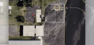
Figure 3 and Figure 4 show the difference between Avmaps’ (Figure 3a/4a) and Google Earth’s Figure (3b/4b) aerial imagery respectively.
Figure 5 and Figure 6 show the setup of the UAV at Archerfield Airport.

Figure 2 – Aerial image with survey control points at Archerfield Airport
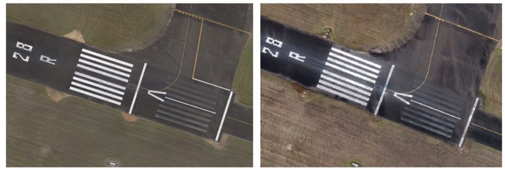
Figure 3(a) – Aerial image taken from a UAV; and Figure 3(b) – Aerial image from Google Earth
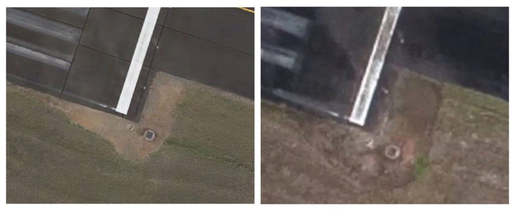
Figure 4(a) – Aerial image taken from a UAV; and Figure 4(b) – Aerial image from Google Earth
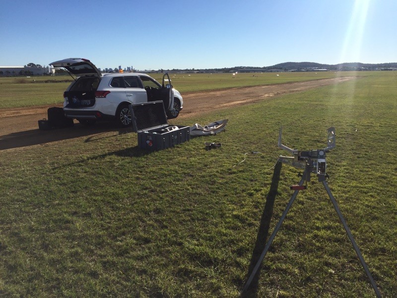
Figure 5 – UAV operational setup by Avmap
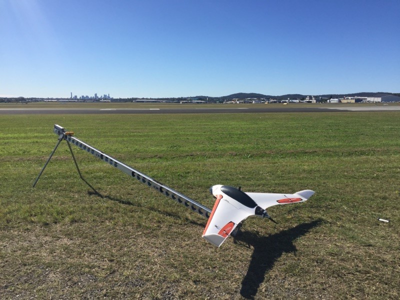
Figure 6 – Avmap’s UAV ready for flying operation at Archerfield Airport
